09:00 AM
TU Berlin, Main Building
10:00 AM

10:30 AM
From ABC to XYZ: location data for non-location developers
by Oliver Fink
Today location content is rapidly becoming part of every industry and almost every application. However, working with location data both as a user and even more so as a developer is still more difficult than it should be and often involves running and operating custom infrastructure. With HERE XYZ we enable everyone – especially non-GIS users and developers - to manage and integrate real-time location data. Download presentation here: 3-ABC-to-XYZ
10:50 AM
Data. Insights. Solutions. – crop nutrition on the spot
by Carl-Philipp Federolf , Jackie Moyes ,
Crop production is strongly influenced by soil parameters and current climatic conditions. These factors determine the growth potential of a specific field. A number of tradeoffs a farmer has to take usually decrease the yield he obtains, compared to the site’s potential. This so-called yield gap leads to a utilization of only 20% (in smallholder markets) to 80% (in professional markets) of the yield potential. One possibility to close this gap is to provide farmers with insights – the combination of data and knowledge. In the past decades, the possibilities to gather data on farms massively increased, but the breakthrough of precision farming did not yet happen as link from data acquisition to actionable recommendation is often lacking. Yara has a record of providing tools that automatically deliver adapted recommendations to farmers, however – they require significant investments in physical sensors. Latest developments in the remote sensing area open opportunities to open this knowledge to a broader range of farmers. Delivering these insights and recommendations based on a combination of remote and on-field sensing an in a useful way to the farmer, requires deep knowledge in number of disciplines like agronomy and GeoIT, but also AI and user experience design.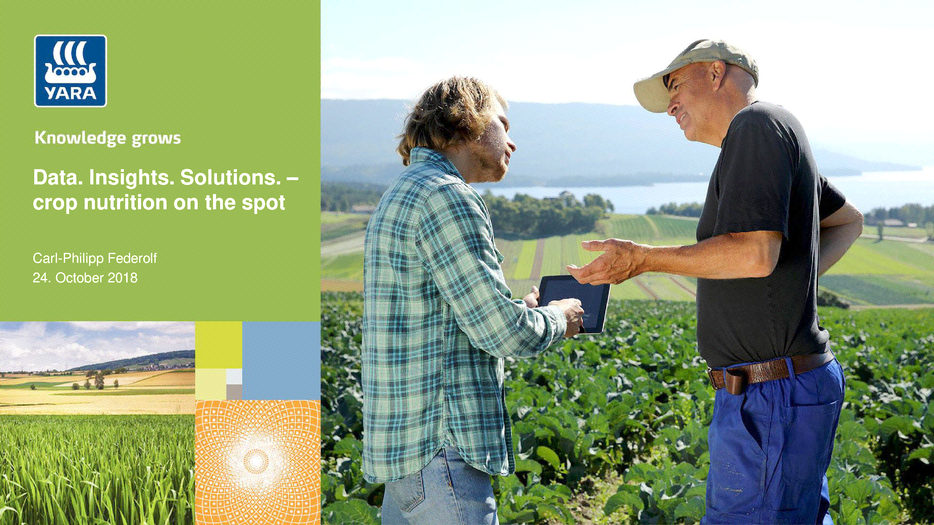 Download presentation here: 4-Data. Insights. Solutions. – crop nutrition on the spot
11:00 AM
11:10 AM
Machine Learning for Transport Modelling: the Next Generation of Transport Models
by Andreas Wolf , Benno Bock ,
To gain the perfect service area for shared mobility operators, we use data-driven business analytics approach instead of a classic transport model as it has been used by others. The essential factor for the determination of an optimal home area is the best possible understanding of the movement patterns occurring in a spatial unit to be investigated. In the past, mobility surveys using fewer counting points and traffic models derived from them were the means of choice. In recent years, however, aggregated and anonymised mobile phone movement data have taken this place. Mobile network data has therefore become a viable source of information and is essential as data basis for this process. The main problem for this procedure, is the availability of floating phone data. Certain areas with a low availability have to be modelled in regards of demand and origin-destination patterns. By using a machine learning approach for demand modelling, we increase the spatial coverage. The approach considers Europe-wide context information for land use, population, POIs and other uniform and area-wide geodata. With this machine learning based on mobile network data, mobility demand and movements can be estimated. Europe-wide scaling is potentially possible for metropolitan regions.11:30 AM
12:00 PM
enviroCar – a Citizen Science platform for Sustainable Traffic
enviroCar is an open platform for collecting and analyzing car driven tracks. The collected tracks consist of GPS positions enriched with additional sensor information by utilizing the vehicle’s inertial diagnostic capabilities. Based on the sensor information, fuel consumption and CO2 emissions are estimated for petrol cars. Users have full control on their collected tracks and can share them in an anonymized fashion via an open API. Various analysis tools support the exploration of the data, e.g. in map-based views or time-series charts. In this talk, we first provide an overview on the enviroCar platform. Afterwards, we present results from previous projects using enviroCar including an evaluation of traffic lights along major roads in Mönchengladbach. Finally, we illustrate current research challenges by introducing the CITRAM project, a project funded by the German Federal Ministry of Transport and Digital Infrastructure.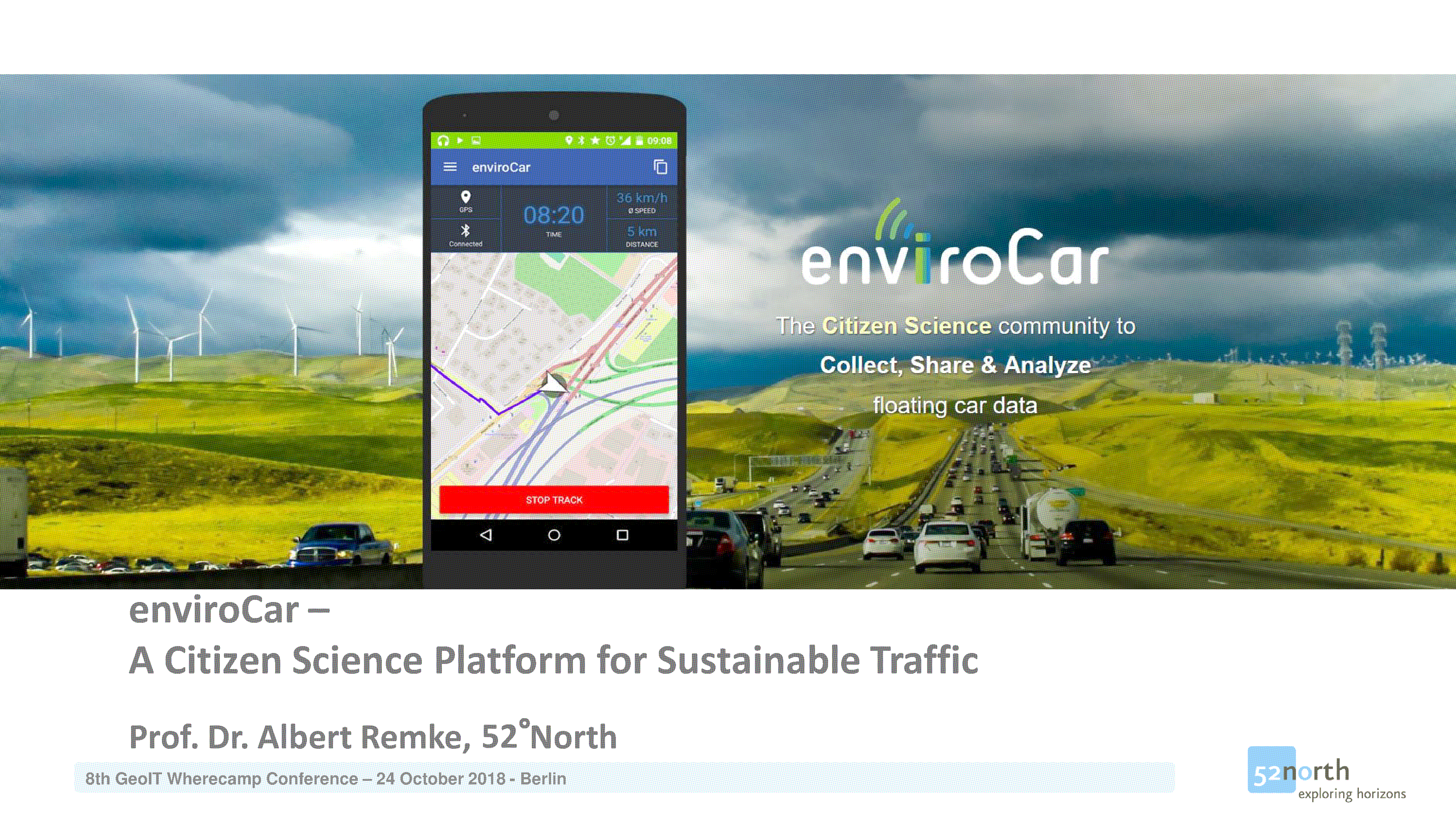 6-EnviroCar-AlbertRemke-52n
12:20 PM
GeoAI: feature extraction and classification
by Peter Rose
The amount of earth observation imagery available has multiplied exponentially in the age of satellites and drones. But how can we take advantage of this vast data source and turn it into valuable insights in near real time? Traditional methodologies of extracting and classifying features of the earth's surface are time consuming and labour intensive. Orbica's solution to this problem is to automate using artificial intelligence (AI) deep learning algorithms and geospatial processes. We've invested in research and development to build our solution and have applied it to waterbodies, roads, vegetation and building outlines. This tool has many uses, from identifying informal settlements to providing valuable datasets for urban planning, environmental management, disaster response and humanitarian mapping. It has also been applied to business problems such as change reporting and build progress reporting. Though AI has been used by the geospatial community for a long time in the form of remote sensing, supervised/unsupervised classification, feature extraction etc. it had a limited scope and required resource expensive multispectral/hyperspectral imagery. Now, with proliferation of AI in almost all sectors of our economy such as autonomous cars, healthcare, finance, agriculture, asset management etc. it has grown the number of players exponentially. For example, it is now possible to use tools developed to identify faces in a picture to identify potential pests and diseases in crops. GeoAI uses the power of machine learning and deep learning, such as convolutional neural networks (CNN), to identify building footprints, water bodies and land use, and classify them based on core geographic principles. The tool then applies geoprocessing techniques to further classify and improve these features and prepare for consumption into mapping applications and other geospatial workflows. All the results from the tool feedback to the AI model to increase accuracy and precision of the datasets, which results in an ever-improving dataset.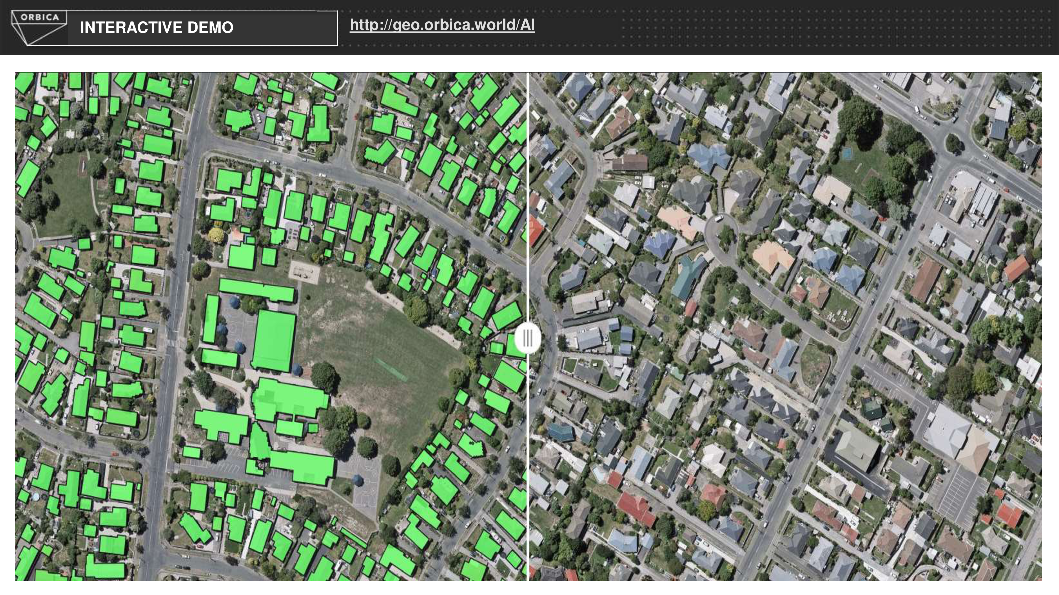 Download the presentation here.
12:40 PM
Localization Service Using Sparse Visual Information Based on Recent Augmented Reality Platforms
8-Localization_service_JRO_CIThe ability to localize precisely within a known space, would allow many use cases on the context of Location-based augmented reality. We propose a localization service based on sparse visual information using ARCore, a state-of-the-art augmented reality platform for mobile devices. Our service is constituted by two components: front-end and back-end. On the front-end, using the point cloud generated by ARCore as feature points, the corresponding binary keypoint descriptor algorithm like ORB or FREAK is computed to describe the place. On the back-end, this binary descriptor is searched in a map using the bags of binary words technique, responding with the position of the recognized place. Online Demo Video: https://youtu.be/4gG3JjAgRFM Download Presentation here.
01:00 PM
02:00 PM
Progress in indoor navigation
by Emrah Kutlu
step-by-step navigation in public transport stations 1) step-by-step navigation in apps based on OpenStreetMap 2) Beacons - why beacons - specifications - configuration and installation 3) realtime positioning based on beacons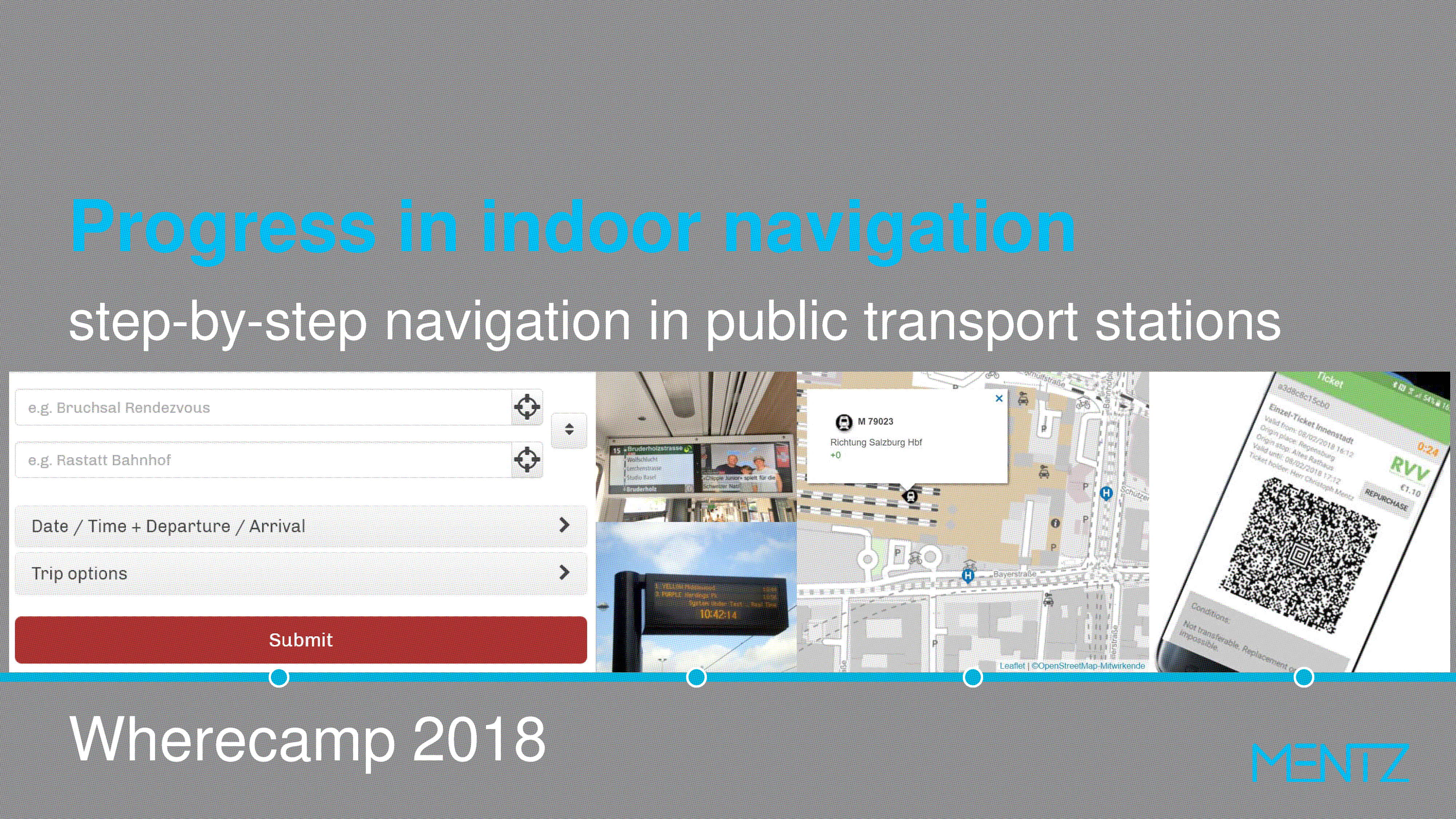 Download presentation here: 9-Mentz_Wherecamp2018
02:20 PM
Navigation for blind or visually impaired
Indoor navigation is an emerging trend among venues and people are willing to benefit out of it. When is comes to a person with visual impairment, navigation services are becoming a necessity to be autonomous and independent. Since 2014, we deliver such services covering variety of venues through out the world. With a technology agnostic approach we developed, ambient sound, or radio signal and computer vision based applications for blind and visually impaired. For the diversity of venues, we have installed our solutions to university campuses, government buildings, airports, train station or shopping malls. Over 30.000 unique users have utilized navigation services 250.000 times in 50 different venues. 10-Sarper Silaoglu-GeoIT Conference Presentation
02:40 PM
Geocode – An intuitive geo location code
by Ervin Ruci
Encoding geographic coordinates into a string is a trivial thing. Yet, there are many grid based systems (geohash, PlusCodes, Mapcodes), and some even turn the thing into a business (Zippr, What3Words). I agree with the commonly stated motivation that Latitude and Longitude are not sufficient for identifying a place in both an unambiguous and human friendly way. A single string for this pair of numbers is a better representation, if only it can preserve all the information contained in the original latitude,longitude pair, something no existing geo-encoding system does. That's my goal.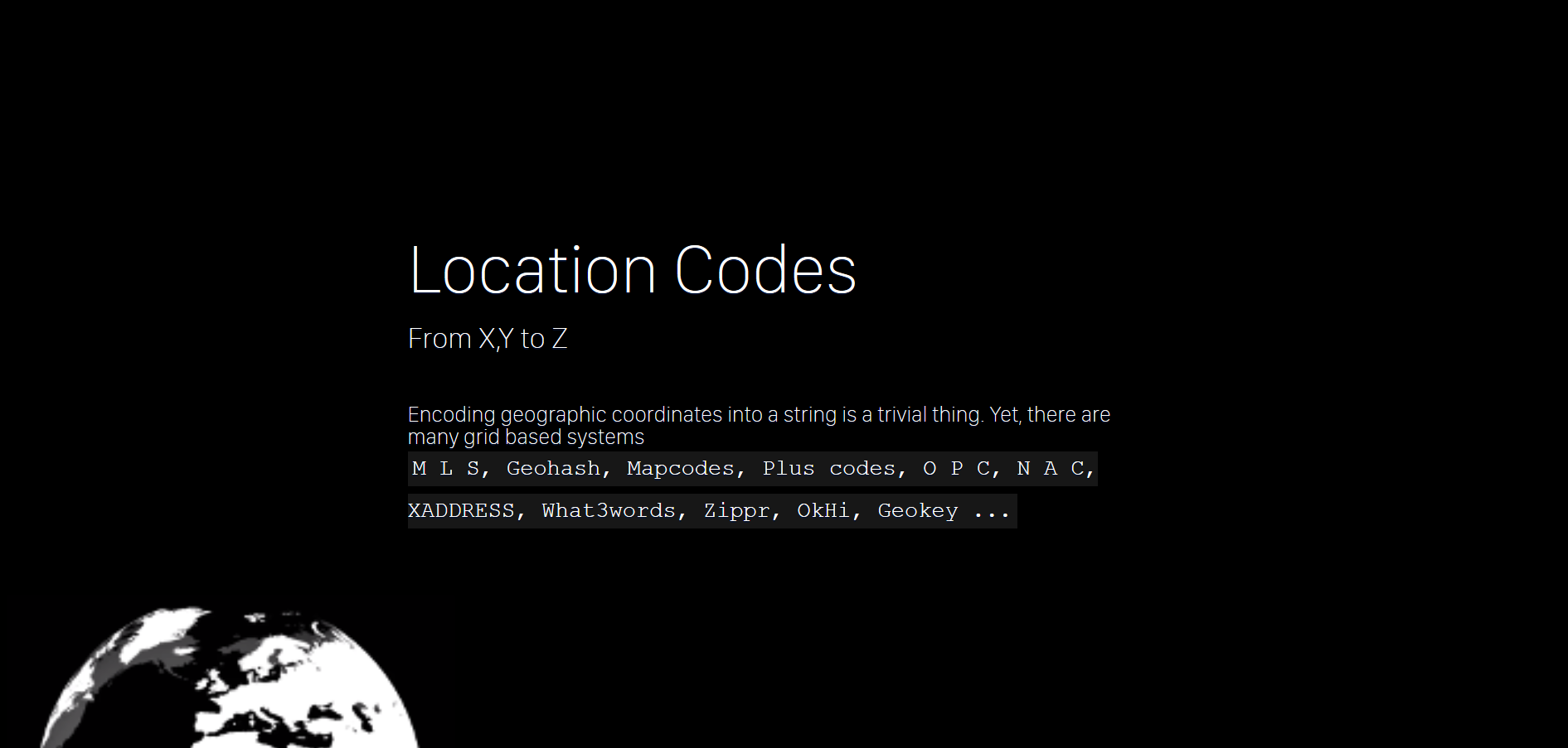 Download presentation here: 11-Geocode-An intuitive geo location code
Homepage: http://geocode.xyz/
Download presentation here: 11-Geocode-An intuitive geo location code
Homepage: http://geocode.xyz/ 03:00 PM
Outdoor meets Indoor at Numbered Gateways
Considerations about a cooperative Gateway Numbering Approach This paper is a collection of early thoughts to refine last meter navigation based on observations in highly urbanized cities via numbered and published gateways (including entrances and exits). A new organizational and technological infrastructure can solve the distribution requirement from building operator via internal or external editors to the GeoIT providers and finally into the hands of visitors. Because many buildings operators are slow in digitalization, an alternative external capturing and publication process via an association could push the approach in a consistent way forward. This paper fits into the Work-in-Process category and is an invitation to join. Keywords—indoor; orientation; multi building operator; multi GeoIT Provider; organizational infrastructure from local to global;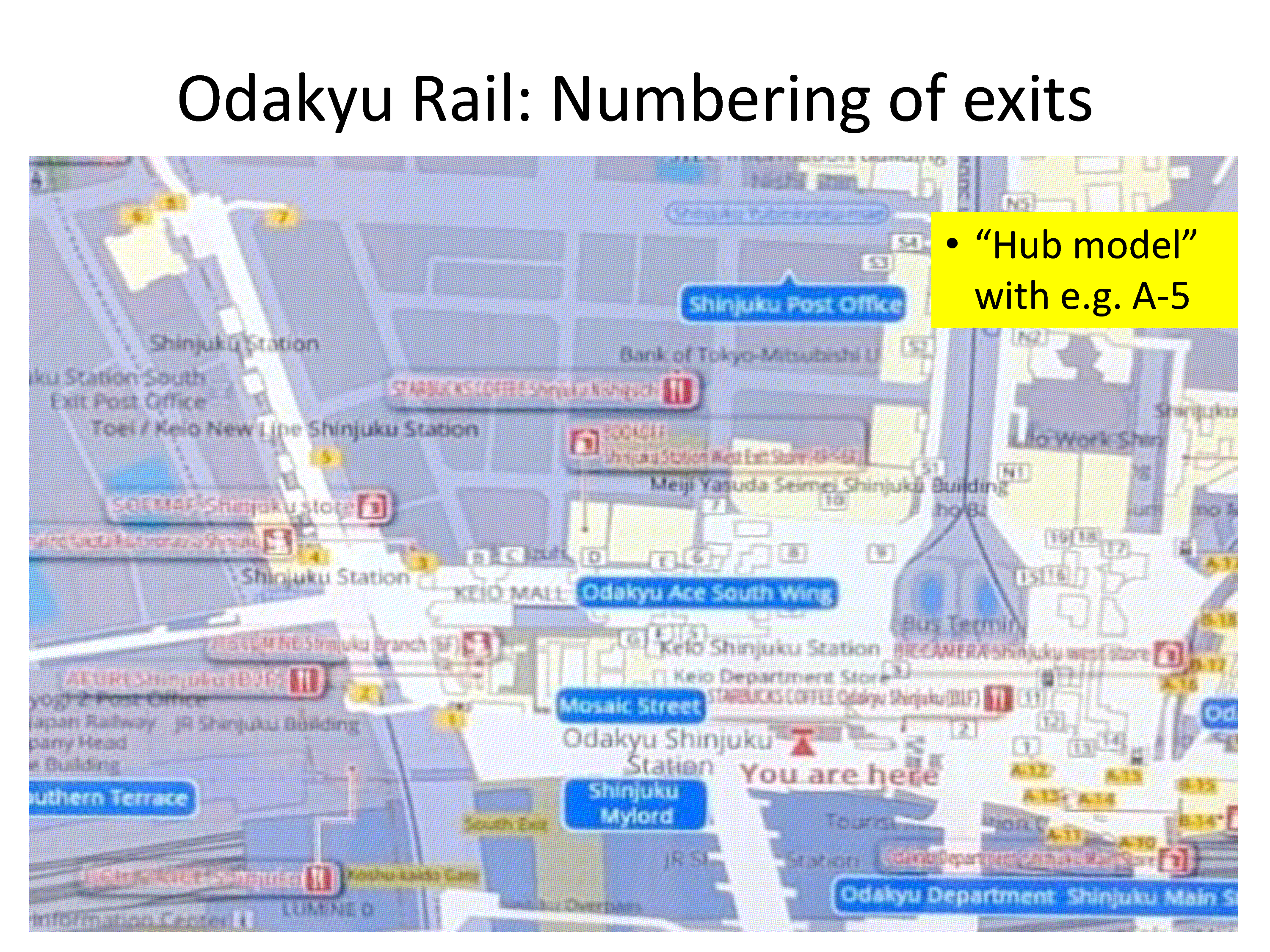 Download presentation here: 12-presentation-Wherecamp2018-Outdoor meets indoor at the numbered gateways-Wagner
Download paper here: Outdoor meets indoor at the numbered gateways-Wagner-v6 12-paper-Outdoor meets indoor at the numbered gateways-Wagner
Download presentation here: 12-presentation-Wherecamp2018-Outdoor meets indoor at the numbered gateways-Wagner
Download paper here: Outdoor meets indoor at the numbered gateways-Wagner-v6 12-paper-Outdoor meets indoor at the numbered gateways-Wagner03:20 PM
03:40 PM
How Future Citizens of Smart Cities Take Benefit from Geofencing Technology
by Dr. Sandro Rodriguez Garzon
An Urban Air Pollution Alert Service During the last decade, urban communities started to digitize their cities as an attempt to meet the digital native’s future needs such as the intention to publicly access real-time information about the city’s current state. The recent availability of small, energy-efficient, interconnected and cheap air pollution sensors makes it thereby possible for a smart city to instantly measure the air pollution level that the citizens are currently exposed to and to share it with the citizens concerned. Unfortunately, today the resulting insights about the current air quality need to be actively queried by the citizens, leading to situations in which the citizen is exposed to a high air pollution without being aware of it. In this talk, I will introduce the context-aware air pollution monitoring and alert service Airtify that proactively notifies citizens via mobile devices about highly relevant air quality information once they enter an area with an air pollution that exceeds a user-defined threshold. The service continuously determines the concentration of particulate matter throughout a given urban area, detects closed areas with a high air pollution and shares this information with the citizen’s mobile devices. The latter component is thereby responsible to regularly measure a citizen’s geographical position and compare it against the areas of poor air quality. Airtify is an exemplary Smart City application that makes use of a combination of urban sensing and geofencing technology to provide an add-value service to environmentally-aware citizens of future urbanizations. Download presentation here: 13-Sandro Rodriguez Garzon-SNET_Wherecamp
04:00 PM
Bridge Monitoring in the Internet of Things
The permanent observation of infrastructure and terrain is an important task field of modern engineering geodesy, ensuring stability and functional reliability of buildings such as bridges. Open-source software, rapid prototyping technologies, and the emerging Internet of Things can help to facilitate the realisation of modern sensor networks while lowering installation and operating costs. The talk will show the application of the OpenADMS software for deformation monitoring of two motorway bridges in Lower-Saxony in the last two years. Go to presentation: https://dabamos.de/slides/geoit2018/04:20 PM
Drawing your Path: Making Realtime GPS Art for a Creative Exploration in Long Distance Sports
In sports like hiking, running and cycling, large distances are covered. With the increasing popularity of sports social networks, few individualists came up with a creative way of defining new routes to leave no chance for boredom. In a manual process, blueprints and overlays in combination with routing tools have been used to make so-called GPS art. In this work, we propose an interactive system for a creative route creation in unfamiliar areas for amateur athletes. In a user study, we investigate how creative route creation methods can affect exploration behavior and route choice of users.04:40 PM
Smart Multispectral Monitoring System for the Real-Time Estimation of Water Stress in the Crop and Automatic Irrigation (PLANTSENS)
by Lukasz Rojek
Water is one of the vital resources of agricultural plants. The quality, growth and health of the crop are directly related to the water supply. To achieve a precise and targeted irrigation that is matched to the actual crop need, the water status must be constantly monitored. Moreover, it is particularly important in a protective environment like greenhouses with additional irrigation but also in the open field, where resource-sensitive use of water is necessary. The combination of thermal and short-wave infrared imagery for remote sensing of the transpiration and the absorption/reflexion from plants has great potential as a tool for indicating irrigation need as well as for improved crop management. This potential is being used within the framework of the PLANTSENS project for developing multisensor monitoring system for automatic irrigation based on the real-time processing and analysing of the multispectral images and precise georeferencing. Download Presentation here:16-Smart Multispectral Monitoring System fo-LukaszRojek
05:15 PM
Assembly of the Association for Geoinformatics, GeoIT and Navigation e.V.
The following topics are scheduled according to our statues:- Annual report of the Management Board,
- Annual report of the Treasurer,
- Report of Cash Auditor,
- Relief of Management Board,
- Voting of President and other members of the Management Board,
- Voting of Cash Auditor
- Geschäftsbericht des Vorstandes,
- Geschäftsbericht des Schatzmeisters,
- Bericht der Kassenprüfer,
- Entlastung des Vorstandes,
- Wahl des Präsidenten und der übrigen Mitglieder des Vorstandes,
- Wahl der Kassenprüfer.
05:40 PM
Closing with Beer & Wine
Lichthof06:00 PM
Schleusenkrug, Müller-Breslau-Straße - 10623 Berlin / Charlottenburg
Schleusenkrug